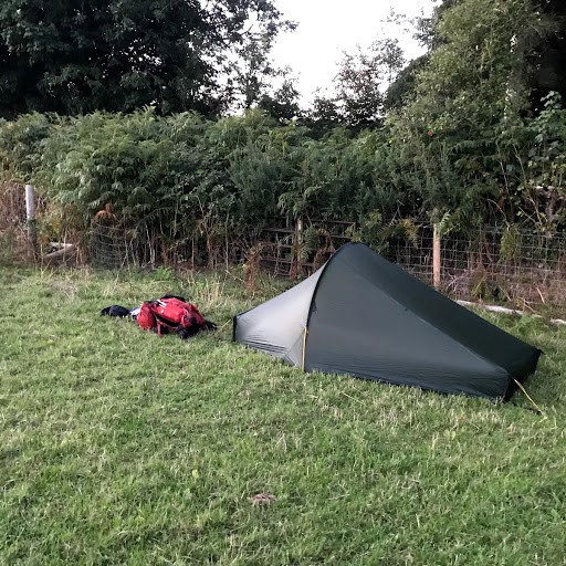


There is no actual official starting point for the way, except Chepstow which is actually not in Gloucestershire as is evident when crossing the 'Old' bridge being faced with the county sign and also being 'England'. I'd caught the train down early evening and planned to walk 4-5 miles before finding a wild camp site for the night, then off to Parkend in the morning. It's all uphill to start before emerging at a road. Confusingly the turning is further up the main road than implied by the route description but after a failed attempt, I located it and finally left the town and into the countryside and more uphill. I had thought I'd camp by the Queen Victoria monument but on arrival it didn't look too inviting so I continued on through the woods. Time moved on and nothing in the way of a suitable camp site presented itself. Don't panic, something will come up. Parsons and Poors allotments both came and went with nothing and eventually popped out at a road. Turning left and more uphill. I must have missed the turning and arrived at the top of the hill and guess what, straight ahead, a large flat field. Walking in, perfect! It was almost dusk so quickly pitched my tent in the corner and was soon in and settled for the night. I'd done about 5 miles at this point so was happy enough with that.
The following morning was clear and bright and after breakfast and a brew I packed away and was away before 7:00am back down the hill to locate the path. In the morning light the path was easy to find and only about 100 yards down the hill, but would have been well hidden on the way up. A mixture of woodland and tracks with occasional nice views across the River Severn. Clanna Woods is confusing, There are two paths into the forest with the right hand one signposted to Clanna Lakes - that is the wrong one! Take the path on the left.
This leads into the Forest of Dean proper which rapidly becomes a bit of a nightmare to navigate. There are tracks leading off left and right and guide is rather vague here. Even at one point the main track goes left with a small track straight on which looks like it hasn't been used for a hundred years - yes, that's the one! I fought the undergrowth and finally emerged on the other side to finally come to a small pond which at last confirmed my choice as being correct. Guidebooks like these suffer from a major flaw in that they don't put the route into a wider perspective so even consulting my (electronic) map didn't really help. I finally figured it out by heading North with the argument that eventually I would come to somewhere I could relocate.
Bream was the next problem area with a couple of non-existent tracks and the fact that the guide fails to mention that you need to walk just past the 'Bream' town sign before turning left. That would have helped enormously. I struggled through and found myself on a long path down to Parkend. I had no need to go into Parked so continued across the road in the direction of Nagshead which is the subject of the next section.
Thus far it is pretty obvious that the guide is out of date in several places and too many assumptions are made that the walker 'knows' the way - in which case, what is the point of the guide? Also, signposts are very sparse in places and could certainly be improved. On the other hand, the guide is well over 10 years old, even the revised version so I guess changes are inevitable.
