

| 100 Miles long | Official Guide Available |
| Gloucester to Hereford | 32.5 miles |
| Hereford to Worcester | 36.0 miles |
| Worcester to Gloucester | 34 miles |
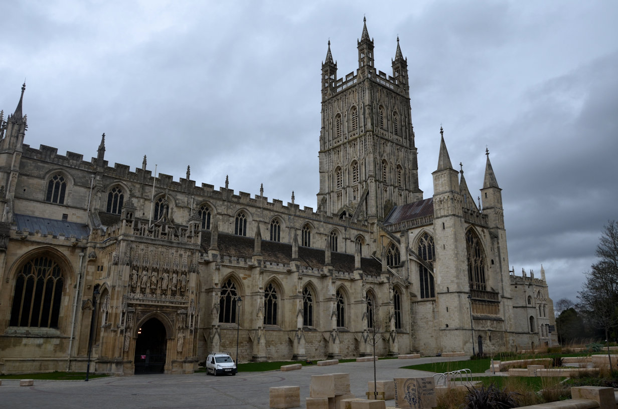
The route proper starts at the Cathedral which is pretty much in the centre of Gloucester and easy to find, being much taller than surrounding buildings. Leaving Gloucester is quite straightforward, especially if, like me, you've walked the Severn Way - it retraces the steps out of town and over the Telford Bridge to 'Over'. Here, the Ways part company with the Three Choirs heading North West to Lassington, leaving the busy A40 quite quickly. Lassington is something and nothing, although does boast an unusual 'church', or at least a tower of a church, the rest having been demolished in 1975 declared unsafe. It is worth a slight detour to read the history of the church but of course it is locked.

From here the route heads out into a huge field with no obvious signage. The best method is to aim for the hedgerow mid-field, then turn right and footpath signs will be spotted just down the slope. An easy path is followed above a disused railway line, which, through the trees is almost indistinct to Rudford, over a bridge and down again onto the disused railway line which is now more apparent than earlier. This part was particularly muddy, being home to several horses and the owner has very thoughtlessly put barbed wire across the entire track with no means of crossing! Being reasonably tall, I was able to push the top wire down low enough to step over - vertically challenged may find it harder! There was also a gated track into the church which I noticed had a padlock on - why? I have no idea.
Follow the line until it arrives at the Newent to Gloucester road, cross that and follow obvious tracks to Tibberton a mile or so distant. Just about here the weather which had been getting steadily more grim now began a pattern of light rain, stop, light rain, stop - 'Intermittent Showers' I believe the weathermen call it, in an attempt to make it sound better. Well, intermittent or not, on came the waterproofs, just in time as it turns out. I'd noticed an obvious rain blanket moving towards me which I realised needed to be defended against. Even though all of my gear was in waterproof stuff sacs, I also put the rucsac rain cover on. Walking through Tibberton and out past the very pleasant church, open fields are soon reached, but the path is not obvious, or rather, it is but you need to take care as it is not straight ahead, but slightly left. I'd noticed the signage was pretty good up until now, despite some reports that I've read to the contrary.
It is about here that the Wysis Way is joined for a while. It seems to me that there are just too many Long Distance footpaths. So far today, I've encountered the Severn Way, the Gloucestershire Way and now the Wysis Way, and I'm actually on the Three Choirs Way! Spoiler alert - later on I'll encounter the Wye Valley Walk, the Daffodil Way and (a) Herefordshire Circular Walk. Of course it could be that the Author of this walk wants us to sample his other offerings (Gloucestershire and Wysis) so gives us a taster, or maybe there's just no choice.
A lot of the next section blurs into one with fields, stiles aplenty, some woodland and varying terrain from track to easy path to muddy path and back again. I took my lunch break at Little Cugley, but didn't stop long as it was quite cold. Heading off and around Newent Woods was easy but unexciting walking, but arriving at Briery Hill Farm provides some light relief as it is a Llama Farm. The Llama seem reasonably friendly although the ones I encountered eyed me with some disdain initially before warming to my presence. I chose to return the compliment, ignoring them, or at least, pretending to until they came to me. Being a commercial farm, the owners seem to have gone to great lengths to ensure that paths are well signposted (and therefore followed) and I was quickly through and on the track down to the main road. More unremarkable footpath walking with unremarkable views eventually pops out at the site of Newent Colliery, which, by all accounts was a disaster (in terms of its viability) and quickly abandoned. All that remains is the spoil heap which is now quite overgrown so no eyesore. Talking of eyesores, the M50 is crossed shortly afterwards which, by Motorway standards is quiet, but even so, disturbs the otherwise peaceful countryside in a rather depressing manner. It is here that the Daffodil Way is followed through Dymock Wood. That particular path is only two miles long and is supposed to celebrate the wild daffodils in the woodland. I always have mixed feelings walking through woodland - on the one hand it is very pleasant, on the other hand, stupendously easy to take the wrong track, so I read the directions with care. I need not have worried, the path is obvious and there is a comforting 'Three Choirs' signpost at the end.
I'd planned to make Much Marcle this evening as my stopover point but the legs were beginning to tire and I noticed that I had now covered half of the total distance for the two days. Determined to continue I pushed myself on with the argument that it was still quite early (not yet 4pm) and I had a couple of hours of daylight left at this time of year (March), plus, every mile walked today was one less for tomorrow so a moral boost if nothing else.
St Marys Church at Kempley Court is a pleasant church and one worth a visit I would think. Today I stopped for a quick photo, then continued on my way. It was pretty much straight ahead until the Marcle Road was reached where a half mile or so bought me into the Village. The guide claims shops, a pub and all sorts of excitement. Well, there is a Village Hall, a School, no shops that I saw and the pub is a further half mile or more out of the village.
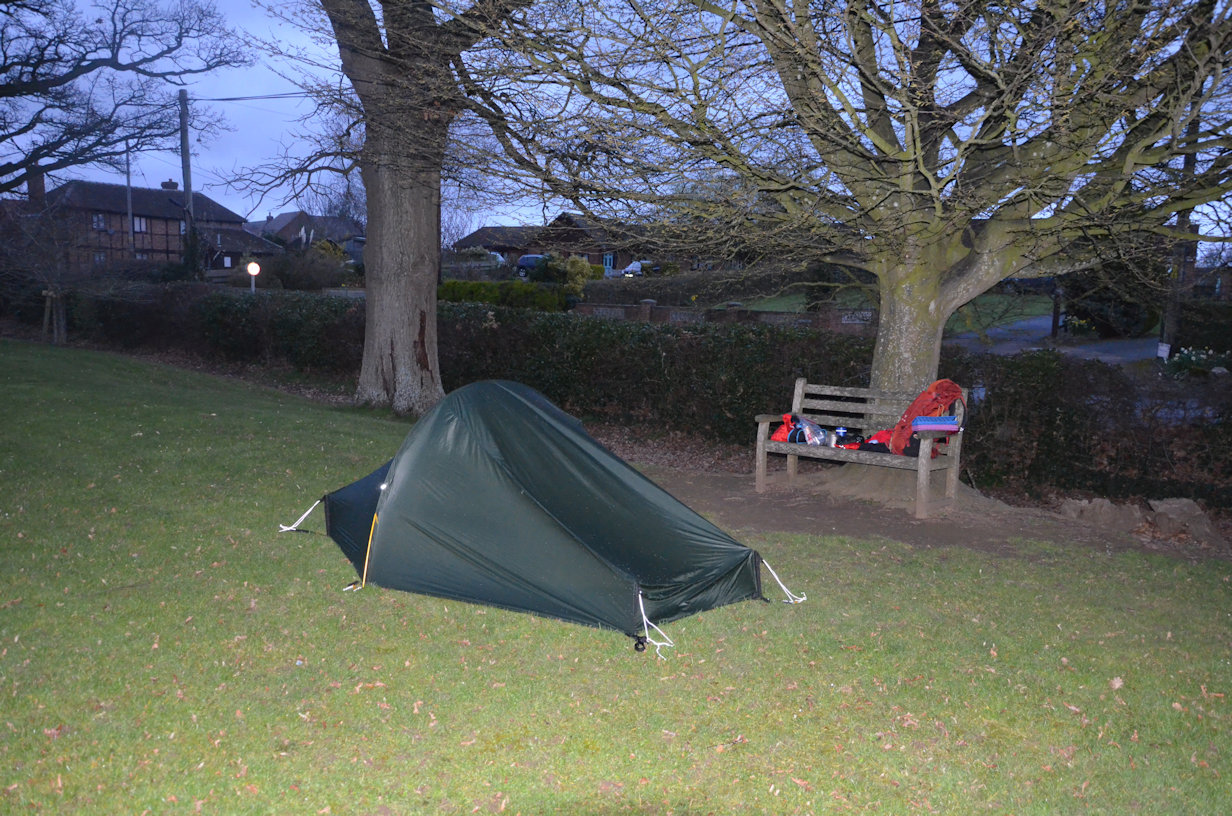
I'd recee'd the area previously and had decided to camp on the field next to the school and opposite the Village Hall. This proved inspired as the hall was open so I took the opportunity of refilling my water bottle before setting up camp for the night. Slightly concerned that the locals may object to someone camping in their village I waited a while until the light began to fade before setting up camp and preparing my meal. The tent took less than ten minutes to erect and dinner a further twenty minutes to prepare, so I was completely done well before dark. Of course, with wild camping, there is nothing to do once it gets dark so I finished up, tidied the tent and was asleep by about 7:30pm

My alarm went off at 6am and I woke feeling very refreshed. By 7am the tent was packed, breakfast eaten, tea drunk and all my rubbish deposited in the Village Hall skip. There was nothing to indicate I'd been there apart from a slight flattening of the grass. I am a great believer in leaving no traces and I can never understand why people leave rubbish - you bought it in containing the food or liquid, surely you can take it out empty? I guess it's a combination of thoughtlessness and laziness. Personally I voice my opinion to anyone I see littering the countryside - there is absolutely no need and gives walkers a bad reputation.
Marcle Church, about five minutes from my campsite boasts an Oak Tree that is reputed to be at least 1,500 years old and some claim 2,000. Either way it is impressive, big enough to have a seat inside the trunk that could easily seat four or five adults. From the church the Way drops down to a road and up the other side. I felt pretty good as I had much less to do today than yesterday, but even so, my legs soon began to complain as I made the ascent - one overnight camp does not take away the effort of a twenty mile walk with a big pack!
Marcle Ridge proves to be quite a climb, not steep, but long and relentless. The large Radio/TV mask denotes the summit, or near enough, and, to my surprise, there is a Trig Point on the path, hidden in the trees. I can't ever recall seeing a Trig Point actually in trees like that, but I'm sure they exist. There are excellent views from here across to the Malvern Range and Ledbury. Sat on the trig point was a painted stone. I've encountered these in the past - they are a fun idea that involves decorating a pebble and then 'hiding' it for someone to find. Once found, the finder should photograph it which can then be put onto the local Facebook Group before re-hiding it for the next person. I carried the stone down to Woolhope where it was carefully hidden (on a bench!).
Out of Woolhope and steadily up to Haugh Wood which was particularly muddy and required some care to avoid the worst of it. Negotiating the wood takes some care as the description makes assumptions about paths. I had pre-programmed 'View Ranger' on my phone with the route in some detail so referred to that on a couple of occasions to ensure I was still on the right track (I was). I find the 'app' very useful, but it can only give back what you put in, so it is worth spending the time adding fine detail, particularly if there is the potential for navigational errors, in woods for example. On the way through I spotted a seat and given that my stomach had been complaining for a while, decided that, even though it was only 10:30am, it was lunchtime.
Leaving the Woods, Mordiford is soon reached which, despite the promise of a shop, doesn't seem to have any such thing, but maybe I couldn't find it. Onward and out over Mordiford bridge, I was slightly alarmed to see that the River Lugg had flooded! Oh dear, my route followed the Lugg for a while. Luckily the route was in the embankment which was well above the water line so I could continue without concern (or could I?!). It had been windy pretty much all day so far but here it just got silly, almost knocking me over at times it was so strong and was to continue right into Hereford. The two days had been long and hard but with the addition of a strong headwind, the last five miles or so were really tough.
Hampton Bishop proved to be slightly confusing, the Wye Valley Walk turned away from the river earlier than I was expecting and I had presumed it was followed into Hereford. Checking the guide showed that the Three Choirs continues further along before leaving the river, but then a second problem when I reached Court Farm - a gated road! I realised I was inside the gates so had to climb the small wall to get onto the Lane. With my legs aching and my pack heavy, it seemed to be a big ask but somehow I managed to struggle over it.

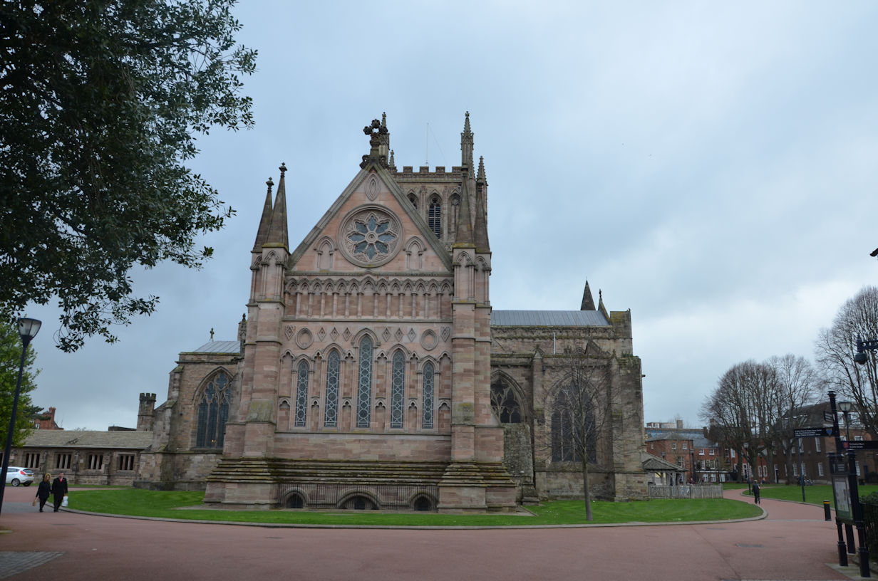
Crossing over the main road, the walk was supposed to cross a small footbridge and out to the Wye. The footbridge was actually under water and the Wye completely flooded! There was no way I was going back and onto the road, so followed the high embankment in the direction of Hereford. A couple of fences barred my way, requiring climbing, but eventually I arrived in the Hereford suburbs. Walking into town to the Cathedral also had its' share of problems with flooded paths so I contrived a route to arrive at the Cathedral by other means. Hereford Cathedral is very pleasant and an excellent end to two days of walking. I felt too tired for a tour of the Cathedral though so headed off to the Railway Station and my train home.