

| 210 Miles long | Official Guide Available |
 | |
| Shropshire Sections | |
| Worcestershire Sections | |
| Gloucestershire Sections |
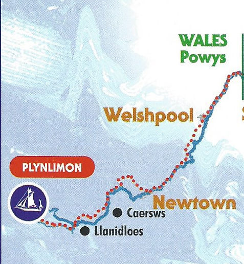
As a casual reader you might be slightly confused by the reports of this Long distance path. The first section was walked last and the section from Llanidloes to Caersws was the second to last section I actually walked which in some ways was a good thing as the countryside improves as the source approaches. To make matters worse some of the sections were walked against the flow and some with the flow. Either way I've done the entire way from source to outflow at Bristol and the following pages describe the route in its entirely.
To get to the source from the nearest car park is just under four miles and mostly uphill, but it has to be done. Leaving the car park, it is pouring with rain, so full waterproofs are on from the start. The signs are good and clear and lead the walker straight down to the river, no mucking about in forests here! Almost immediately there is a boardwalk, presumably to protect the riverside wildlife from human hoof prints which is does admirably. It works well and has been well thought out with anti-slip mats on every section. Eventually this gives way to a forest trail which then starts to work its' way uphill - no surprise there, we are heading for the source of a river.
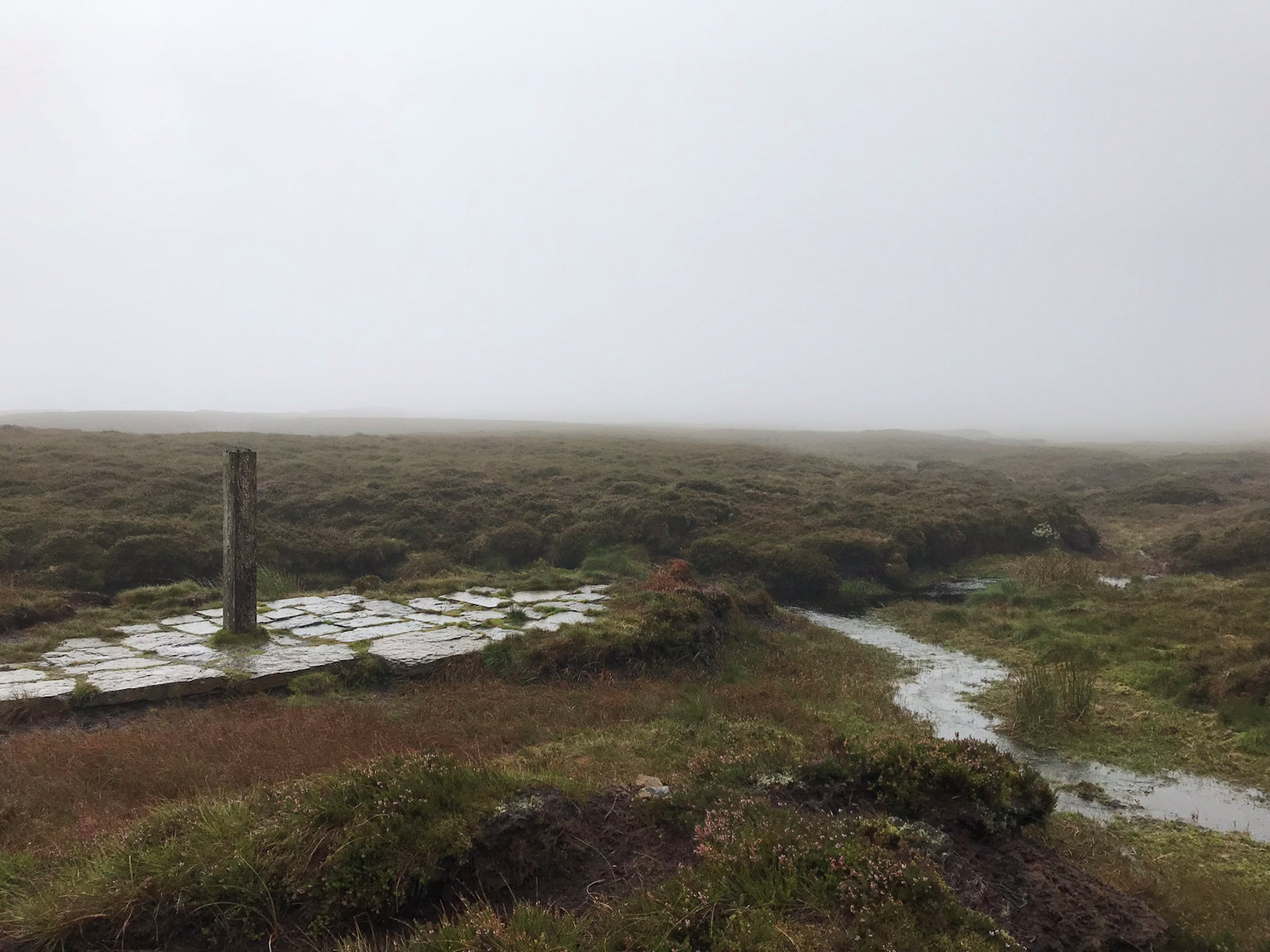
Climbing up there is no need for the guidebook which I stash away at a quick stop to remove my waterproofs as it has now stopped raining and I am warming up. Onward for about half a mile when the heavens open again with an accompanying wind - back on with the waterproofs! Upward I am informed that it is 3/4 mile and described as 'arduous'. Well, maybe, but on I go determined to get to the source and the actual start of the walk. It is on a good flagstoned path at a nice gradient so hardly 'arduous' but hey ho. Eventually I reach a large post boasting the 'Source of the River Severn'. I've made it in one hour and ten minutes - the expected walking time on the boards near the car park reckoned 4 hours so somewhat pessimistic. A moments reflection of the miles done along this river, from here at literally a small pool all the way down to Bristol over 200 walking miles where it is almost 4 miles wide. Of course there is the small matter of walking back down to the car park, then on to Llandiloes to complete the only section not yet walked.
Back down is easy going and within an hour I am back at the car park and onwards through a wide field and along more boardwalk to reach a bridge. Across I go but shortly see another bridge with a sign. Odd, but I go down to it. It is the bridge back across the river at the 'Severn-breaks-its-neck' waterfall and very impressive it is. From there the route rises to the forest road.
Unbelievably and very disappointingly, the next four or five miles are along the road following the route driven in. With all of this amazing countryside around it is hard to believe there are no alternatives but I press on regardless. Eventually I reach a fork in the road which provides a small distraction from the relentless straight road, but all it does is to recross the river then turn up a small lane which similarly continues right down to within a kilometre of Llandiloes. Recrossing at Short Bridge, a small path leads along the bank of the river up to Long Bridge and back across again. My day is complete at this point as the next section has already been done.
Leaving the town over Long Bridge I followed the Way signs left and uphill before turning into the forest. Being a forest it is designed to confuse of course. There are good signs initially but then the way turns up and back on itself which seems contrary to the way the guide shows but I followed it anyway. The path then turns back in the right direction although there is no official Way sign it turned in the right direction so I was happy to follow it. There are "alternative route" signs so I was not worried but when I emerged onto a golf course it was unexpected. I figured out that I needed to descend downhill and back into the left end of the forest heading in the general direction of the road which I worked out was ahead by the sound of cars.
I soon reached the road and followed it up quite steeply which provided the excellent views promised by the guide. I was back on track.
From here it was a combination of lanes, farm tracks and fields, all of which were very pleasant and very quiet, not a single fellow walker all day. The river is notable by its absence though for most of the section.
Near Waen I decided it was time for lunch so found a quiet place to stop, but nowhere to sit so I stood and admired the view instead.
More well signposted walking and as a bonus the most amazing view of two Buzzards hunting up and down the hillside. Not once did they flap their wings, yet they moved along the hillside back and forth climbing up and down as the mood took them.
Finally I started the descent down towards Caersws eventually popping out on a lane which lead to the main road into the village and up to the crossroads which signalled the end of the day for me as this was the starting point for the next section which having already done follows on from here.
I used the Maesmawr Farm Campsite as a starting point. It is a very pleasant well-equipped camp and lodge park and to be recommended! Setting off early I headed into Caersws about a mile away and quickly picked up the Severn Way signposts - there is one on the corner of the road. The village is soon left behind and fields entered with a fleeting view of the river, which would not be visible again until Newtown more than two hours distant.
The route heads into the Welsh countryside with a vengeance. Anyone doing this walk and expecting a flat walk will be in for a surprise on this section which features some interesting climbs, some quite steep as it makes its way around a large North-East, then South-East loop. On the tops it felt very cold with a biting wind, but once sheltered felt warm enough - the usual hat on/hat off game was played for some time. Eventually Newtown comes into view with a steep downhill into the town. A short section of road before disappearing into the park (the signpost is very overgrown and hard to spot), crossing the river over a pedestrian suspension bridge, then following a path along the river, avoiding Newtown Centre, although it is only a minute or two diversion, before recrossing the river again to leave Newtown behind. The river is followed for some time although the path soon becomes the Montgomery Canal towpath. The canal at this point being barely wet and certainly not navigable, although it does become more so not too far away. By now it had warmed considerably and I removed a layer to enjoy the Spring sunshine.
Further down the towpath the river left my sight as it twisted and turned and the canal became wider and more like a proper canal. At bridge 159 there was a marked change. Barges could have easily got to that point and I imagine in times gone by continued into Newtown. Along the path there were periodic boards giving a brief history of that section of the Canal, very informative and a nice account of times gone by - better times? Maybe. By Berriew the river was well out of sight and the canal became a long plod with very little change in scenery.The Breidden Hills to my right were a constant sight and I reflected that I have never climbed them - something to address on a future visit maybe? Brynderwen signalled lunch as there was a nice view of the canal, a bench and it was lunchtime! Disappointingly the A483 ran close to this point, but it is not far away for many miles so no point continuing in the hope of tranquility.
The path and canal cross the main road a number of times, unavoidable but I always hate it when I am out walking to have my peace shattered by road traffic, especially when crossing a road - no-one ever considers slowing down or stopping, they are far too interested in their own urgency than to be considerate. Eventually Welshpool came into view, although not before a signpost appeared to direct the walker in the opposite direction - err...no!
At the main town bridge, there is a museum; Powysland which signalled the end of the days walking for me. I had booked into the Royal Oak hotel which was just a couple of minutes up the road. Perfect!
With an easier day and a meet time of 4pm I dawdled over breakfast and took a walk around Welshpool which is a very nice town and would benefit from a return visit. Eventually I had to leave so set off back down to pick up the Canal from where I left it - it was still there, waiting patiently. The canal is followed for several miles before being joined by Offas Dyke footpath. Now many years ago I walked Offas Dyke and remember it as being either uphill or downhill with no flat bits, but here it was following the canal - how the memory plays tricks!
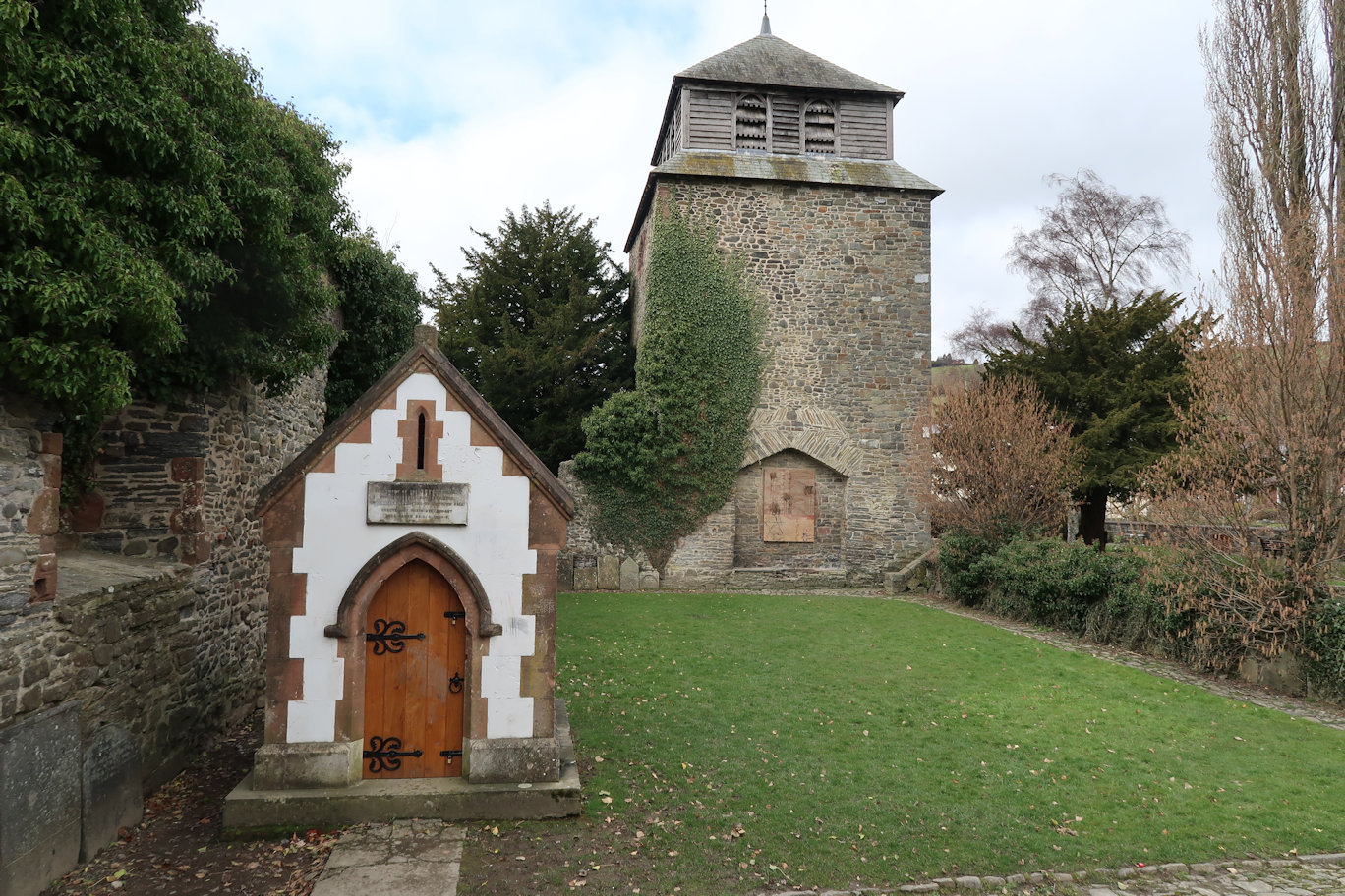
Again the canal follows the main A483 for some time, until crossing it one final time to meet up with the River, which I last saw yesterday afternoon sometime. Goodbye Canal, hello river. Offas Dyke path continues for another couple of miles until we say farewell to that as well as it heads North for Prestatyn and the North Wales coast. We start to turn Eastwards with England in our sights. The actual border is on the river at the bridge near to Crews Green. Care should be taken on this bridge - it does not fit walker and motorist side by side and like the motorists on the A483, they are no more courteous than they were there. Soon over we head to Melverley which has two things of note; 1. A really beautiful church and 2. A lack of signposts! Powys should get a medal for being signposters of the decade. I could have walked this far without resorting to the guide at all. Here I am in England and Shropshire for five minutes and already scratching my head! As it turns out, the path takes a right to the main road, then straight across a field, then another field and another. Signposting is there but you have to pretty much know where you are headed. Emerging onto the main road, well, main lane I follow this for a short while until confusion reigns once more. A road junction with no visible signage, but a footpath sign pointing into a field. I figure I am at a road junction marked in the guide (I am not) so follow the path into a small field. There is no escape! A wide stream runs all the way round it! Back again. I decide to check with 'Google Maps' and discover that I am one junction too early.
Walking down to the next junction, the guide informs me I should go through a gate - well, climb over it then across a field. I do so, but notice to my left, a footpath sign and stile. Doh! Again, no signage. Forward through a caravan site with some very dodgy stiles and into a muddy field with no ongoing signs. I head for a gap in the hedge hoping it be correct - it is and continue to another lane. Finally Pentre appears which seems to be a huge MoD area. It is lanes now until the finish. For lanes that don't really go anywhere, they are incredibly busy which annoys me - I get annoyed very easily when walking and coming into contact with motorised vehicles. Finally I reach my end point. More or less a random point on the lane, but the point I got to from the other direction on a previous outing, so the sections are now stitched together and all is good with the world. My ride appears a few minutes later and we head off towards Caersws to collect my car, passing many of the sections of the walk.
